Lab news and web postings:
-
September 22, 2016 - Documentary film from our lab obtains prestigious award
Our micro-documentary "Mangroves" obtains the prestigious Jackson Hole WILD - WGBH Science Media Award, sponsored by the AAAS.
"Mangroves" obtains first place in the Jackson Hole Science Media Awards
The science video "Mangroves", a result of collaboration between Jaime Rojo, a freelance photographer at Mexico City, Octavio Aburto at Scripps Institution of Oceanography UCSD, and Exequiel Ezcurra at Botany & Plant Sciences, UC Riverside, has won first prize in the 2016 Science Media Awards within the category "Micro Movie". The festival is organized by Jackson Hole WILD and WGBH Television (a PBS member station in Boston). The Science Micro Movie category is sponsored by the American Association for the Advancement of Science (AAAS).
The list of awardees can be seen in Science Media website: http://www.sciencemediasummit.org/2016-media-competition.html.
The full micro-movie can be seen at the "Natural Numbers" website: http://www.thenaturalnumbers.org/mangroves.html.
Here's an image of the formal announcement, at WGBH Television in Boston, on September 21st 2016.
(photo credit: Jaime Rojo)


-
March 29, 2015 - Blue carbon in desert mangroves
With less than 1% of the area, ca. 30% of regionally sequestered carbon is stored beneath the roots of mangroves along the coasts of Baja California.
Investigadores de la Universidad de California y el CIBNOR estiman la capacidad de almacenamiento de carbono en los manglares desérticos de México.
Un grupo binacional de investigadores encontró que manglares pequeños que crecen a lo largo del desierto de Baja California almacenan hasta cinco veces más carbono bajo tierra que sus exuberantes equivalentes tropicales. Este nuevo estudio estima que los manglares desérticos, que sólo representan menos del uno por ciento del área terrestre del noroeste de México, almacenan casi el 30 por ciento del carbono de la región.
“Los manglares representan una delgada capa entre el océano y la tierra, y sin embargo vemos un ecosistema que está almacenando mucho carbono en un área muy pequeña”, dijo Paula Ezcurra, autora principal del estudio.
El estudio, publicado en la edición del 28 de marzo de la revista Proceedings of the National Academy of Sciences, es el primero en estimar el carbono acumulado en la capa sedimentaria de turba del manglar, y recalca la importancia de entender mejor las condiciones de la historia natural donde crecen los manglares para estimar con más exactitud su capacidad global de almacenamiento de carbono.
A lo largo de las costas tropicales, los manglares prosperan en condiciones cálidas, salinas y lodosas. Los investigadores de Scripps colectaron muestras de sedimento de núcleos profundos tomadas bajo las raíces de los manglares en dos lagunas desérticas —Bahía Magdalena y Balandra— y dos densas lagunas tropicales —Marismas Nacionales y La Encrucijada— y calcularon el carbono almacenado en los cuatro sitios.
Los resultados demuestran una capa de 2,000 años de raíces sin descomponer, o turba, de hasta cuatro metros de profundidad bajo los manglares desérticos. La turba se comporta como una esponja para el carbono atmosférico almacenado, y aporta una crónica de la historia del aumento del nivel del mar en la región.
Los científicos descubrieron que los manglares desérticos restringidos a las ensenadas rocosas de la escabrosa costa de Baja California han estado creciendo sobre sus propios restos de raíces por miles de años para compensar el aumento del nivel del mar, acumulando una capa gruesa de turba bajo sus raíces. En contraste, los manglares en llanuras costeras muy planas han acumulado una capa de turba más delgada, dado que con el tiempo han migrado conforme el nivel del mar aumentaba o los sedimentos de los ríos desplazaban la línea de costa.
“Los resultados demuestran cómo estos ecosistemas han estado adaptándose al cambio climático y al aumento del nivel del mar por miles de años”, dijo Octavio Aburto-Oropeza, profesor asistente en el Centro para la Biodiversidad Marina y Conservación de Scripps, quien ha estado investigando los servicios económicos de los manglares en México, y en particular en Baja California, por más de 10 años. “Entendiendo la relación entre la historia natural y la capacidad de almacenamiento de carbono en los ambientes de manglares podría darnos una mejor comprensión del cambio climático y del incremento del nivel del mar en el futuro”.
Según la CONABIO, los manglares de México han estado disminuyendo un tres por ciento por año debido al incremento de actividades humanas a lo largo de la costa. Según este nuevo estudio, la eliminación de los mangles da como resultado la liberación inmediata de miles de años de carbono almacenado que retornan a la atmósfera, y suprime un ecosistema natural capaz de secuestrar carbono de actividades humanas, acentuando aún más el cambio climático.
“Nuestro estudio ayuda a cuantificar más a fondo el valor de los ecosistemas de manglar, y resalta la importancia de la conservación de estos bosques costeros si realmente queremos cumplir con las metas nacionales de reducción de emisones”, dijo Exequiel Ezcurra, profesor adjunto de Scripps y profesor de ecología en la Universidad de California, Riverside. “Espero que sirva para subrayar la urgente necesidad de la protección de los manglares y para promover una valoración seria de los servicios ambientales proporcionados por recursos de acceso común”.
Contactos: Paula Ezcurra
1-619-504-5429; Paula Ezcurra [pezcurra@ucsd.edu]
28 de marzo de 2016
Fotos para acompañar la nota:
1. A pesar de su tamaño pequeño, los manglares de la costa del Golfo de California almacenan inmensas cantidades de carbono bajo sus sedimentos, comparables a los manglares tropicales más densos, y diez a cien veces más que las selvas tropicales húmedas (foto: Octavio Aburto).
2. Hojarasca de mangle rojo en el Golfo de California (foto: Octavio Aburto).
3. Bajo el lodo superficial de los manglares del desierto los núcleos revelan grandes depósitos de turba acumulada (foto: Matt Costa).
4. La turba acumulada puede llegar hasta 2–3 metros de profundidad, con edades de más de 2000 años (foto: Matt Costa).
5. El muestreo de núcleos demandó un esfuerzo de equipo (foto: Octavio Aburto).
6. El muestreo de núcleos a profundidad requiere de energía para perforar (foto: Octavio Aburto).
7. Procesado de muestras en el laboratorio (foto: Octavio Aburto).
8. Los densos bosques de La Encrucijada, en la costa de Chiapas, almacenan tanto carbono como sus contrapartes del desierto (foto: Octavio Aburto).
9. Los aparentemente insignificantes manglares de El Mogote, frente a la ciudad de La Paz, pueden tener tanto carbono por unidad de área como los bosques tropicales más densos en materia orgánica (foto: Octavio Aburto). -
June 26, 2015 - The end of Isla Rasa? (in Spanish)
Warming seas and overfishing drive seabirds away from the Gulf of California
l aumento en la temperatura del mar y la presión pesquera aleja a las aves marinas de sus sitios ancestrales de anidación en México hacia los puertos industriales de California.
México es famoso por sus agregaciones de especies migratorias, como la mariposa monarca, la ballena gris, y las aves marinas de Isla Rasa, en el Golfo de California. Fuentes significativas de ingreso regional, estas colonias reproductivas son un escaparate mundial donde se muestran los éxitos de conservación mexicanos.
Más del 95% de la población mundial del charrán elegante y la gaviota ploma —casi un millón de aves marinas— se reúnen cada año para anidar en Isla Rasa. Desde que el naturalista L. W. Walker describió el fenómeno en 1953, la isla ha sido un imán y fuente de inspiración para turistas, naturalistas, productores de cine e investigadores.
Sin embargo, en algunos años de las últimas dos décadas las aves marinas han llegado a la isla en abril, como normalmente lo hacen, para abandonarla poco después sin haber anidado. El primero de estos sucesos ocurrió en el año de 1998, cuando ocurrió un fenómeno de “El Niño” de gran magnitud, pero luego la deserción de la colonia volvió a ocurrir en 2003 y a partir de entonces se ha vuelto recurrente con creciente frecuencia: 2009, 2010, 2014 y 2015. Los investigadores se han preguntado a dónde van las aves cuando abandonan su sitio de anidación ancestral, y cuál es la causa para que desistan de anidar en su ámbito histórico, el Golfo de California.
Un grupo de investigadores de México y los Estados Unidos de Norteamérica se propusieron analizar qué estaba sucediendo con los charranes elegantes (Thalasseus elegans), una especie que puede ser usada como indicador de la dinámica del océano. Los resultados, publicados en la revista Science Advances (Enriqueta Velarde, Exequiel Ezcurra, Michael H. Horn, y Robert T. Patton. Warm oceanographic anomalies and fishing pressure drive seabird nesting north. Science Advances 26 de junio 2015) señalan que el cambio climático y la sobrepesca están produciendo, de manera combinada, el colapso ecológico de la región de la grandes islas en el Golfo de California.
Usando censos de nidos en México y California, encontraron que el charrán elegante se ha ido expandiendo desde el Golfo de California hacia las costas del sur de California en las últimas dos décadas, pero expansión fluctúa de un año al otro de manera irregular. “Cuando los charranes perciben que las condiciones en el Golfo son inapropiadas para asegurar su éxito reproductivo,” dice Enriqueta Velarde, líder del estudio, “se van a sitios alternativos de anidación en el sur de California, incluyendo la Bahía de San Diego, la Reserva de Bolsa Chica y el Puerto de Los Ángeles.”
La decisión de permanecer en el Golfo o emigrar al sur de California está relacionada al hecho de que durante los últimos 15 años el Golfo de California se ha estado anómalamente caliente durante algunas temporadas. “Cuando la temperatura de las aguas del Golfo sube de manera anormal, explica Exequiel Ezcurra, colaborador de muchos de la Dra. Velarde, “el agua superficial más cálida forma una tapa que no permite que las aguas frías del fondo, ricas en nutrientes, afloren a la superficie. La productividad marina disminuye y, con ella, decae también la disponibilidad de peces pelágicos menores, de los cuales se alimentan las aves marinas.” El estudio muestra que el colapso en el alimento de las aves, que resulta del incremento de la temperatura del agua, se agrava con la reducción de la población de sardina generada por la captura intensiva de su pesquería en México. Al encontrarse sin alimento las aves marinas dejan el Golfo para dirigirse a la costa del sur de California.
La mayor frecuencia con que actualmente se producen las anomalías cálidas en la temperatura superficial del Golfo de California, correlacionada con el calentamiento global de los océanos, y la sobrepesca de sardinas y otros peces pelágicos, fuerzan a las aves marinas a alejarse en busca de ambientes más productivos, aun cuando esto represente abandonar su sitio ancestral de anidación a favor de ambientes altamente transformados por la industrialización, como la Bahía de San Diego o la terminal de contenedores del Puerto de Los Ángeles.
Liga al artículo original: (Velarde, Ezcurra, Horn, y Patton. 2015 Warm oceanographic anomalies and fishing pressure drive seabird nesting north. Science Advances 26 Jun 2015: Vol. 1, no. 5, e1400210. DOI: 10.1126/sciadv.1400210 5)Nota de Medios AAAS (Eurekalert): http://www.eurekalert.org/pub_releases/2015-06/uoc--was062415.php
Fotos de apoyo:
Foto 1. Momento del éxodo de los Charranes Elegantes de su colonia en Isla Rasa en abril 2010, cuando la falta de alimento en el Golfo de California los obligó a abandonar el área (Foto: E. Velarde). 
Foto 2. Vista parcial de una colonia en buenas condiciones anidando en Isla Rasa, en el año 2011 (Foto: E. Velarde). 
Foto 3. Gaviotas depredando los huevos de los Charranes Elegantes después que éstos abandonaran la colonia por falta de alimento en mayo de 2009 (Foto: E. Velarde). 
Foto 4. Barco sardinero en la región de las grandes islas del Golfo de California, subiendo la red de cerco después de un lance pesquero en 2013, cuando la captura de sardinas en el Golfo comenzó a colapsarse (Foto: E. Velarde). 
Foto 5. Como resultado de la falta de alimento en el Golfo de California, los Charranes Elegantes migran ahora hacia los puertos y bahías del Sur de California, donde el alimento es más abundante (Foto: E. Ezcurra). 
-
March 30, 2015 - The Human Footprint in Mexico
Modern land transformations still bear the memory of past civilizations
Modern development or deep history? What lies at the core of land transformation and ecosystem degradation in Mexico?

Using data on land use and transportation corridors we calculated the human footprint index for the whole of Mexico to identify large-scale spatial patterns in the anthropogenic transformation of the country’s land surface. We developed a map of the human footprint for the whole country and identified the ecological regions that have most transformed by human action. The results have been published in the journal PLoS ONE (González-Abraham et al. 2015).
We conclude that the spatial spread of the human footprint in Mexico is both the result of the limitations imposed by physical geography to human development as well as of a complex history of past civilizations and technologies, including the spatial pattern of ancient settlements that were occupied before the Spanish Colony.

-
May 21, 2013 - Sardine early warning system
Seabird monitoring can help fishers and managers predict sardine declines.
Seabird monitoring can help managers predict sardine declines
Want to predict the success of next season’s sardine fishery? Look at the seabirds!
In a recent paper published in Scientific Reports –Nature magazine’s open-access journal– we showed that seabird diets provide an early warning of sardine declines, and that monitoring what seabirds eat could help fishers manage the sardine fishery more sustainably.
Shortly after, Conservation magazine, the influential environmental journal of the University of Washington wrote a note echoing our research. We wish the fishing fleet would take our findings as seriously as these researchers from Washington.
Seabird monitoring can help managers predict sardine declines

-
May 3, 2013 - Watch 62 years of global warming in 13 seconds
My friends and colleagues Margarita Caso and Irene Pisanty have directed my attention towards this NASA video depicting 62 years of measured thermal anomalies on the Earth's surface.
Watch 62 Years of Global Warming in 13 Seconds

NASA scientists have produced this amazing 13-second animation that depicts how temperatures around the globe have warmed since 1950. You'll note an acceleration of the temperature trend in the late 1970s as greenhouse gas emissions from energy production increased worldwide and clean air laws reduced emissions of pollutants that had a cooling effect on the climate, and thus were masking some of the global warming signal.
Global temperatures have warmed significantly since 1880, the beginning of what scientists call the "modern record." At this time, the coverage provided by weather stations allowed for essentially global temperature data. As greenhouse gas emissions from energy production, industry and vehicles have increased, temperatures have climbed, most notably since the late 1970s. In this animation of temperature data from 1880-2011, reds indicate temperatures higher than the average during a baseline period of 1951-1980, while blues indicate lower temperatures than the baseline average. (Data source: NASA Goddard Institute for Space Studies. Visualization credit: NASA Goddard Space Flight Center Scientific Visualization Studio) As NASA notes: "The global average surface temperature in 2011 was the ninth warmest since 1880, according to NASA scientists. The finding continues a trend in which nine of the 10 warmest years in the modern meteorological record have occurred since the year 2000."
-
April 20, 2013 - Wilflowers course: Field trip to the Santa Rosa Plateau
Year 2013 is unusually dry, and poor in Spring Wildflowers. We went up into the Santa Ana mountains to find cooler, wetter environments, where some flowers could still be seen in bloom.
Good field day, but a dry year for wildflowers
A high-pressure atmosphere and a warming coast maintained the weather cloudless over Southern California. The air was balmy, the light was amber... a perfect spring day for a field trip:

(MODIS image of Southern California, April 19th, 2013)
Despite the perfect day, moisture-wise the season is not really that good, as sunny days come at a cost: Year 2013 is unusually dry, and the legendary California Spring Wildflowers have been reluctant to bloom. Because all natural sites around Riverside are basically parched by the dry spell, we went up into the Santa Ana mountains to find cooler, wetter environments, where some flowers could still be seen in bloom. This is our group picture at the visitor's center of the Santa Rosa Plateau Ecological Reserve:

(for a high-resolution copy, simply click on the image)
Thank you, Rachelle Lan, for a great photo!
Another group photo was also contributed by Flor Valdez (thank you Flor!)
")
(for a high-resolution copy, click on the image)
Flor also contributed a nice photo of the fiddleneck plant (Amsinckia menziesii, Boraginaceae), shown here:

(for a high-resolution copy, click on the image)
-
April 12, 2013 - Eric Mellink wins the Volkswagen conservation award
Dr. Eric Mellink, a dear friend and collaborator of our Lab, was honored this year with the Volkswagen conservation award. Together with Enriqueta Velarde, who won it in 2011, this is the second time a collaborator of our Lab wins this prestigious prize!
Eric Mellink wins the VW Conservation Science award
Our dear friend, and collaborator of our lab, Eric Mellink, has been awarded today the Volkswagen award for outstanding scientific research in conservation biology “Por Amor al Planeta" (For the Planet's Sake). With Enriqueta Velarde, who won the award in 2011, this is the second time a close collaborator of our lab wins this prize. Congratulations to Eric!
As friend and associate of Eric, I had the immense privilege of making his presentation--his laudatio, as they would say in Europe. The event was in the beautiful pine forests of La Malinche National Park, in Puebla, Mexico. Here are some photos of the ceremony:

Mónica Riojas (Eric's partner), Eric Mellink, and Exequiel Ezcurra.

Preparing the speech (improvising, as usual!)

Mellink's laudatio: Making the presentation of Eric's outstanding conservation work

Generational circles: Eric with Arturo Gómez-Barrero, son of Arturo Gómez-Pompa, founder of UC MEXUS, and Exequiel Ezcurra, current Director of UC MEXUS.
-
December 20, 2012 - Baja California Oases: Another end-of-year land expedition to Baja California
This year we traveled to the historic Jesuit oases of Sierra de la Giganta and Guadalupe, in search of ancient germplasm, traditional crops, and agricultural history.
Historic Baja California Oases

In December 2012 we organized a lab expedition to the wonderful farmed oases of the Sierra de la Giganta and Sierra de Guadalupe. The expedition team was formed by Andrew Semotiuk, Alejandra Martínez-Berdeja, and Exequiel Ezcurra. Here are some photos of our trip.

Orobanche, a root-parasite with no chlorophyll, in full bloom near Cataviña.

Héctor Arce Villavicencio, a traditional farmer of San Ignacio.

The beautiful Mission San Ignacio, a masterpiece of Jesuit ingenuity.

Juanita, in San Ignacio, cutting the fruit of an ancient variety of pummello (toronja).

Spectacular desert pavements south of Laguna San Ignacio.

Alejandra Martínez-Berdeja, botanizing.

Andrew Semotiuk in the old San Isidro dam, Valle de la Purísima.

San Isidro / La purísima: View of the valley.

Stand of pitaya agria (Machaerocereus gummosus) and cardon (Pachycereus pringlei).

Sweet and juicy! Pitaya fruit.

The traditional wine makers at San Miguel de Comondú still use the ancient "Mission grape" variety.

The old church of the San Xavier Mission.

"Kino's olive tree" -- Alejandra Martínez-Berdeja by a three-century old olive tree in the San Xavier oasis.

Andrew's turn by Kino's olive tree! Andrew Semotiuk --barely visible-- embraced by the old stems of the mission olive tree in the San Xavier oasis.
-
September 2012 - Visit to Ecotrust
This organization harbors some of the most innovative thinkers on sustainabiity I know.
Ecotrust is a non-profit organizartion in Portland, Oregon, devoted to inspire fresh thinking that creates economic opportunity, social equity and environmental wellbeing. They promote and foster a natural model of development that creates more resilient communities, economies, and ecosystems in Portland and and around the world. I visited with them for three days, and was immensely impressed by their work.
Its founder, Spencer Beebe, explains some of his ideas on a TEDx talk:
Ecotrust sees urgency in building up an economy that restores nature and invests in people. And they believe the way to build that economy is through bold experimentation in the bioregion they call home — the Pacific Northwest. The Ecotrust people are continually creating and supporting new businesses, nonprofits, alliances, networks and programs that build well-being in nature and community and deliver economic prosperity. The industrial economic model that's reigned for the last 300 years --they say-- simply can't last. It's time for a more natural model of development. At Ecotrust, they believe the new economy starts in our backyards, communities, cities and regions.
While visiting them in Portland, we had to opportunity to exchange ideas on what Wallace Stegner used to call a "sense of place"
What binds together people living near the US/Mexico border? The landscape. And what is the future of conservation? Bioregions, the places bounded by the landscape and people supportive of one another.
We spoke about early people of Baja California living in the mountains during the summer and along the coast during the winter. So the bioregion is the coastline and the mountains because both are needed to support a healthy people. The coast has bountiful food in the winter and the mountains have water and cooler temperatures in the summer. The two areas together with the people make a bioregion. And the health of the people depends on the health of these landscapes. They are connected. To support one, support the other.
It was a great, hopeful visit!
-
December 24, 2011 - End-of-year Baja California land expedition
Returning from a research trip to Cabo Pulmo, we drove along the entire peninsula exploring some rarely-visited places.
December expedition along the Baja California Peninsula
In December 17 I went on three-day diving expedition to Cabo Pulmo with my daughter Paula, a marine biology student at UCSB. Taking advantage of the fact that we were deep south, in the Peninsular Cape Region, we organized a return expedition by land. My daughter Ana offered her van for the trip, and on December 20 we took-off from La Paz together with Roberto Chávez, driving northwards to San Diego. We crossed the Sierra de Guadalupe through the high pass between Sierra de San Pedro and Sierra La Palmita, along a very precarious and rather eroded trail that starts in the ruins of the old Mission of Guadalupe and runs eastwards across the high sierras to the Pacific slope.
A couple of days later we reached Cataviña, in Baja's Central Desert, and spent some time with Nathan Velasco, a very young and very bright local naturalist and photographer, now studying photography, communication, and media arts at the University of Baja California in Ensenada. Nathan took us to see some of unknown cave paintings in the granite boulder caves around Cataviña, with his two lovely dogs "Roca" and "Cocoa". His knowledge of the region, and his love for the peninsular ecosystems are simply dazzling. He has developed a website where he posts his beautiful photography and his innovative conservation ideas: http://nathanvelasco.tumblr.com/. Some of his photos are also available at Mosaico-Natura, a webpage developed by National Geographic en Español and Mexico's National Commission on Biodiversity (CONABIO) to promote the work of young emerging photographers.
Nathan and his family run a wonderful local restaurant in Cataviña, where they serve some of the best Baja California machaca with ranchero-style flour tortillas, salsa and black beans. Add their delightfully fragant, freshly home-brewed coffee, and the most superb palm-date cake ever, and, life cannot get any better.
Here are some photos of our expedition:

Turkey vultures (Cathartes aura, know in Spanish as "auras" or "zopilotes") warm their wings in the early morning sun, Sierra de Guadalupe.

The old cemetery at San José de Magdalena, a beautiful oasis town on the eastern scarpment of the sierra.

Ana's truck "Frida" in the San Pedro pass, ca. 1500 meters in elevation.

The high sierran divide, at an elevation of 1500 meters. Both the Gulf of California and the Pacific Ocean were clearly visible.

Paula Ezcurra studying some ancient pictographs (cave paintings) near Cataviña, in the Central Desert of Baja California.

Under a giant boojum tree (Fouquieria columnaris, known as "cirio" in Spanish). From left to right: Exequiel Ezcurra, Ana Ezcurra, Paula Ezcurra, and Nathan Velasco. Behind the camera: Roberto Chávez.
-
August 12, 2011 - Cabo Pulmo is described by scientists as a living laboratory for ecological restoration
A new scientific study describes Cabo Pulmo, Baja California’s hidden baja undersea park, as the world's most robust marine reserve
A new scientific study hails Cabo Pulmo, Baja California’s most successful undersea park, as the world's most robust marine reserve

A new multi-institutional, collaborative scientific study, co-authored by Exequiel Ezcurra, describes how the Gulf of California's Cabo Pulmo, protected by locals, has rebounded as a biological "hot spot" flourishing with marine life. Cabo Pulmo, a national park thriving with undersea wildlife and tucked away near the southern tip of Mexico's Baja California peninsula, has proven to be the world's most robust marine reserve in the world, according to this new collaborative study conducted by researchers from California and Mexico.
Results of a 10-year analysis of Cabo Pulmo National Park (CPNP), published in the Public Library of Science (PLoS) ONE journal, revealed that the total amount of fish in the reserve ecosystem (the "biomass") boomed more than 460 percent from 1999 to 2009. Citizens living around Cabo Pulmo, previously depleted by fishing, established the park in 1995 and have strictly enforced its "no take" restrictions.
You can read the full paper here: Aburto-Oropeza O, Erisman B, Galland GR, Mascareñas-Osorio I, Sala E, Ezcurra, E. (2011) Large Recovery of Fish Biomass in a No-Take Marine Reserve. PLoSONE 6(8): e23601. doi:10.1371/journal.pone.0023601
A detailed press release can be seen at Scripps' media webpage (http://scrippsnews.ucsd.edu/Releases/?releaseID=1180).
Cabo Pulmo Marine Reserve from Gulf Program on Vimeo.
-
August 10, 2011 - From Sky-Islands to Sea-Mountains: The Ecology and Dynamics of Cornerstone Ecosystems In the Pacific Coastal Drylands:
Many Gulf of California/Baja California fans met at a special symposium during the 96th Annual Meeting of the Ecological Society of America to share ideas and contrast data.
Gulf of California/Baja California symposium

The "Western Flyer", chartered by John Steinbeck and Ed Ricketts for their legendary Gulf of California expedition in 1939.
On the morning of Wednesday, August 10, 2011, as part of the 96th Annual Meeting of the Ecological Society of America, we hosted a symposium titled "From Sky-Islands to Sea-Mountains: The Ecology and Dynamics of Cornerstone Ecosystems in the Pacific Coastal Drylands". The session was organized by Sula Vanderplank, Benjamin Wilder, and Exequiel Ezcurra.
This was the symposium's leitmotiv: Understanding the effects of climatic anomalies on coastal deserts and neighboring marine ecosystems is essential, as these habitats depend on pulses for their renewal, and their biological productivity can change dramatically from one year to the next. Oscillations in oceanic temperatures can strongly modify marine productivity, while ocean-modulated atmospheric anomalies impose similar cycles of drought and rain in deserts. Furthermore, in oceans and deserts the abundance of life is not spread evenly but tends to clump at distinct locations where biological productivity concentrates: In deserts, the collection of water drives these aggregations; in the sea, it is normally nutrient upwelling, rocky reefs, and coastal lagoons which provide the nutrients that sustain large aggregations of life. The symposium brought together terrestrial and marine scientists to analyze (a) how oceanographic anomalies affect resource availability in desert coastal environments, (b) how the spatial distribution of high-productivity ecosystems affects resource conservation, establishment pulses in deserts, fisheries, and freshwater availability, and (c) what is the true value of the environmental services provided by high-productivity environments in both desert and sea, such as mangroves, wetlands, oases, and reefs.
The symposium brought together researchers from UC Riverside, Rancho Santa Ana Botanical Garden, Scripps Institution of Oceanography, Universidad de Guadalajara, CICESE, University of Arizona, CIBNOR, Universidad Veracruzana, UNAM, and University of Kansas-Lawrence.
The meeting was partially supported by UC Riverside funds through UC MEXUS to promote binational research collaborations. We are thankful to the University of California, Riverside, for its generosity and its vision continuing to support collaborative research work between Mexico and the US in midst of difficult financial times.
See more of: the Symposium at ESA's 96th Annual Meeting website.

Symposium participants: Standing, from left to right: Eric Mellink,Sula Vanderplank, Pedro Peña -Garcillán, Octavio Aburto, Rafe Sagarin, Brad Erisman, Xavier López-Medellín, Andrés Lira, Ben Wilder, and Exequiel Ezcurra. Crouching: Mónica Riojas, Enriqueta Velarde, Alejandra Martínez-Berdeja, Charlotte González-Abraham, and Eli Wehncke (click on the image to go to the Symposium's program)
-
May 31, 2011 - Spring Wildflowers field trip to the Santa Rosa Plateau
Group photo of our last field trip.
Botany trip to the Santa Rosa Plateau
Our class trip to the Santa Rosa Plateau was excellent. Despite the prevalent dryness of the lowlands in Southern California, the chaparral and the oak woodlands at the Santa Rosa reserve were still brimming with flowers!
Here is the group photo of the trip, courtesy of Arianna Gomez.

(click on the image to see a high-resolution copy)
-
May 28, 2011 - Cabo Pulmo in danger
Development pressures are putting the most valuable reef in the Gulf of California under serious threat.
Cabo Pulmo in danger
Cabo Pulmo, an outstanding marine protected area in the Gulf of California, and a UNESCO World Heritage Site, is threatened by large tourism and real estate developments.
Octavio Aburto and Enric Sala have recenty published an excellent description of the biological richness of Cabo Pulmo and its threats in National Geographic en Español.

(click on the image to go to the NatGeo article)
With a group of scientists, we have requested UNESCO's World Heritage Committee to add Cabo Pulmo to the agenda for its 35th meeting in June, and consider sending an investigative mission to the area to research the potential damage large tourism projects could cause to the reef, place Cabo Pulmo to the List of World Heritage in Danger, and request the Mexican government to protect Cabo Pulmo by rejecting Cabo Cortés and other detrimental large resort proposals.
Among the signatories of the petition to the World Heritage Committee, we had the honor of having Sylvia Earle, one of the persons in the world that has done more to protect the oceans, a true conservation hero that inspires hope and commitment for nature and for the seas.

Exequiel and Sylvia Earle, San Francisco, May 2011
Cabo Pulmo is the northernmost coral reef in the eastern Pacific, and, at around 20,000 years old, it may be the oldest and most important reef in the American Pacific. It has unique ecological processes, biological communities and physiographic characteristics. Comprised of 25 different species of corals, the reef supports a rich diversity of species, including 154 species of marine invertebrates and 226 species of fish. Its inhabitants and visitors include humpback and Bryde’s whales, tiger sharks, three types of dolphins, manta rays, marlins, tuna and five of the world’s seven endangered species of sea turtles.
The preservation of Cabo Pulmo is a local, national, and international success story. After decades of intense fishing had depleted Cabo Pulmo’s marine life, the local communities secured protected status for the reef from the government. In 1995, the State of Baja California Sur made Cabo Pulmo a Natural Protected Area; in 2000 Mexico dedicated it as a National Marine Park.
In 2005, it was designated a UNESCO World Heritage Site as one of the “Islands and Protected Areas of the Gulf of California.” In 2008, it was dedicated as a Wetland of International Significance under the UN's Ramsar Convention.
After 15 years, the quality of life of local people has increased, and biomass and abundance of predator fish species has also increased. Aggregations of sea bass and groupers keep increasing year after year. A comparative study of the reef fish community from 1987-2006 concluded that since the establishment of Cabo Pulmo National Park, top carnivore species increased in abundance and size, and in general it can be said that the fish fauna shows an excellent conservation status. More importantly, in one decade, total biomass increased dramatically from 0.75 to 4.24 tons per hectare, a spectacular increase of 3.5 tons in each hectare of the protected area. In concordance with this pattern fish biomass has increased significantly in all trophic levels at annual rates varying between 12 and 25%.
However, Cabo Pulmo is now under serious threat. In March, Mexico’s Ministry of Environment and Natural Resources approved key components of Cabo Cortés—one of several large tourism real estate projects that now threaten to harm Cabo Pulmo’s coastal and marine life and the foundation of the local economy. The completed Cabo Cortés project would consist of 15 large hotels with over 30,000 hotel rooms, three to five golf courses, a 490-slip marina, desalination and water treatment plants, a private jet strip, and other infrastructure, adjacent to and directly north of Cabo Pulmo.
The influx of tourism and population growth of a project of this magnitude will bring overwhelming pollution and greater pressure on Cabo Pulmo’s marine and coastal ecosystems.
The vulnerability of corals to human activity and pollution is well-documented, as they are sensitive to changes in water quality, salinity, turbidity and temperature. Sand dredging during construction of the marina and breakwater, fertilizers and chemicals used on the golf courses, discharge from the desalination and water treatment plants, and pollution from the marina’s boats and increased human population would dramatically alter the area ecologically.
Cabo Cortés’s proposal also includes major infrastructure in sand dunes, which would damage the coastline and result in beach erosion of vital sea turtle nesting sites. In our opinion, this development could cause irreversible harm to this unique and vulnerable reef and is inconsistent with its protected status. The need to act is urgent.
-
May 25, 2011 - The origins of mezcal
Dr. Patricia Colunga's 2011 Yarmanos Lecture on the fascinating origins of distillation of Agave spirits.
Dr. Colunga's talk on the origins of mezcal and tequila

Dr. Patricia Colunga and Dr. Daniel Zizumbo, both from the Centro de Investigaciones Centíficas de Yucatán (CICY) visited UC Riverside invited by the Department of Botany and Plant Sciences. Dr. Patricia Colunga gave a talk on the ethnobotany of the genus Agave and the origin and cultural evolution of mezcal distillation in Mexico.
The talk, presented in the Genomics Lecture Hall of the Department of Botany and Plant Sciences as the 2011 Demetrios M. Yermanos Lecture, was also delivered earlier in the day to the students of the Spring Wildflowers course (BPSC 031), who had the opportunity of learning the fascinating facets of modern ethnobotanical research.
Within a long trail of excellent papers on the subject of Agave use and the origins of agriculture in western Mexico, you can download some of the group's most recent papers on the subject:
Zizumbo-Villarreal, D., F. González-Zozaya, A. Olay-Barrientos, L. Almendros-López, P. Flores-Pérez, and P. Colunga-García Marín. 2010. Distillation in Western Mesoamerica before European Contact. Economic Botany 63(4): 413-426, DOI: 10.1007/s12231-009-9103-6
Vargas-Ponce, O., D. Zizumbo-Villarreal, J. Martínez-Castillo, J. Coello-Coello, and P. Colunga-GarcíaMarín. 2009. Diversity and structure of landraces of Agave grown for spirits under traditional agriculture: A comparison with wild populations of A. angustifolia(Agavaceae) and commercial plantations of A. tequilana. American Journal of Botany 96(2): 448–457.
Colunga-GarcíaMarín, P., and D. Zizumbo-Villarreal. 2007. Tequila and other Agave spirits from west-central Mexico: current germplasm diversity, conservation and origin. Biodiversity Conservation 16: 1653–1667.
I have also uploaded Dr. Colunga's slide show in web-readable format for the benefit of all those interested in this fascinating line of research.
Browse and enjoy!
Open publication - Free publishing - More agave
-
May 19, 2011 - Spring Wildflowers trip to Swarthout Canyon
Photos of our course's field trip to the foothills of the San Bernardino Mountains.
Spring Wildflowers trip to Swarthout Canyon and Lonely Pine Canyon
Arianna Shayne Gomez has shared with me some nice photos of our last Spring Wildflowers field trip to the foothills of the San Bernardino Mountains, in the Swarthout and Lonely Pine Canyons (thank you, Arianna!).
In this page I have uploaded low resolution copies. If you click on any of them you will get a high resolution copy that you can download.


-
May 11, 2011 - Ben Wilder's talk on the Tehuacán Valley
A talk for the Spring Wildflowers course on Ben's exploits in a center of arid-plant biodiversity
Ben Wilder's talk on the Tehuacán Valley
Today Ben Wilder gave a great talk to the students in our course BPS 031 "Spring Wildflowers" on the evolution and adaptation of desert plants, with particular emphasis and evolution and diversification of cacti.
The talk was based on, and described, Ben's botanical explorations in the Tehuacán Valley, in the States of Oaxaca and Puebla, in Mexico, a hotspot of desert biodiversity.
Here's a copy of the lecture in web-publishing format.
Enjoy!
Open publication - Free publishing - More biogeography
-
April 23, 2011 - Spring Wildflowers field trip to Rancho Santa Ana
Group photo of our course trip to one of the most amazing botanic gardens in California.
Spring Wildflowers field trip
The first trip of the course "Spring Wildflowers" took place today. We went to Rancho Santa Ana Botanic Gardens, where the students had three activities: (1) A tour of the Gardens led by the amazingly knowledgeable Sula Vanderplank; (2) an ethbotanical tour led by some wonderful Rancho staff members of Native American ancestry, and (3) a visit to the outstanding indoor show of California Spring wildflowers, organized by the staff of the garden and led by our very own, and terrific, Natthanij Soonsawad. Thanks to all our field leaders!
We had very good student attendance, and the class in general seems to be enthused with the subject. I hope everybody enjoyed the trip as much as I did, and, more importantly, learned a little bit more about our rare and interesting local flora.
Group photo

(for a high-resolution copy, click on the image)
-
April 12, 2011 - La Giganta & Guadalupe
Anouncement of the presentation and signing of the conservation book La Giganta y Guadalupe -- Breathtaking images of mountains, oases, and nature.
La Giganta and Guadalupe
The book La Giganta y Guadalupe has just come out. It is illustrated with breathtaking photographs by Miguel Ángel de la Cueva, with texts by Bruce Berger (and outstanding nature writer) and myself (a complete parvenu in the world of literary works and nature writing).
The book has descriptions of the wonderful ecosystems in that lost world of the Baja Californian sierras: the palm canyons, the sky islands, the Pleistocene refugia, the oases still irrigated by the ancient Jesuit acequias, or water ditches.
It is amazing how much of old Baja California still survives in these mountains.
The people there --the descendants of the original Californios-- have taken care of this microcosm with devotion, dedication, and a deep love for their region.
Book presentation and signing will take place at the Centro Cultural La Paz, La Paz, Baja California Sur, on April 16 2011, 7.00 pm.

-
April 9, 2011 - Enriqueta Velarde wins the Volkswagen award
After three decades of amazing conservation work in the islands of the Gulf of California, Enriqueta gets a very deserved recognition.
Enriqueta Velarde wins the VW Conservation Science award

Our dear friend and collaborator of our lab, Enriqueta Velarde, has been awarded today the Volkswagen award for outstanding scientific research in conservation biology “Por Amor al Planeta" (For the Planet's Sake).
I have tried to convince her to spend the money (50,000 dollars) in one great party. Sadly, I think she will pay no attention to me and will spend all the money in her beloved Isla Rasa.
In 1979, Enriqueta—at that time a young student—started a seabird monitoring program in Isla Rasa. Together with her students, she has been working on the island since, in what constitutes one of the most wonderful examples of in-the-field conservation and hands-on science in the world.
For three decades, she has visited the island every spring, and year after year she has followed the nesting success of banded individuals along their entire lifetime. During these years, she has amassed one of the best and most comprehensive databases on seabird reproduction in the world. She also promoted a successful rat eradication program, carried out by Jesus Ramírez, eliminating in one season a dire threat to successful seabird reproduction. Perhaps more importantly, without any weapons or any form of violence, she has been able to dissuade the egg poachers, completely stopping the trade in tern and gull eggs. As a result, the seabird populations, which jointly totaled some 200,000 in the late 1970s, now have reached almost half a million.
Her work was able to turn around an amazing ecosystem. The recovery of Rasa Island is one of the most outstanding examples of ecological restoration in the world, a true comeback from the dark edges of extinction turning the island into one of the most amazing success stories in the world.
It is also an example of what a committed and dedicated person can do for the future of this environmentally-threatened world.
Congratulations, Enriqueta!
Two of Enriqueta's papers in collaboration with our lab can be read here:
Vieyra, Velarde, and Ezcurra, 2008.
Velarde, Ezcurra, et al. 2004.
The great nature writerJulia Whitty (multi-laureate author of Deep Blue Home, The Fragile Edge, and A Tortoise for the Queen of Tonga, and environmental correspondent at Mother Jones), who is also a personal friend of Enriqueta and has spent many days at Rasa collaborating with the project, echoed the news of Enriqueta's award in her highly-read blog "Deep Blue Home".
Whitty's most important book, Deep Blue Home, begins on Isla Rasa in the Gulf of California in 1980, where Whitty spent a field season studying royal terns together with Enriqueta Velarde, then a graduate student completing her dissertation on the breeding colony of Heerman’s gulls. Since then, they have both maintained a close friendship, kindled by their common love for the sea.
A short video on Enriqueta and Isla Rasa by OceanContent's Channel can be seen here:
-
May 27, 2011 - Paul Dayton's 70th birthday
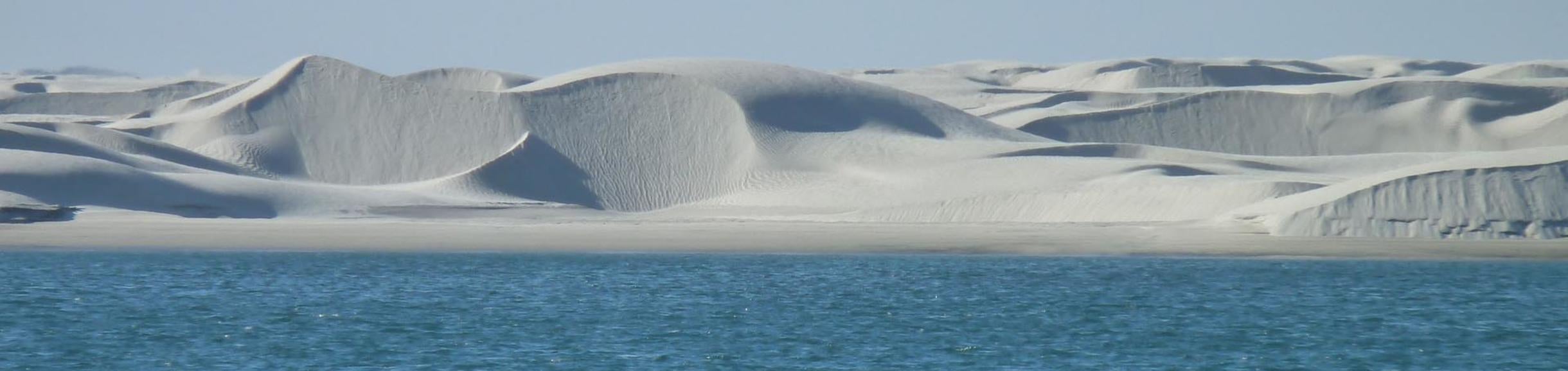
... celebrated in a BIG way at the Gran Desierto dunes and the Pinacate volcanic shield!
Paul Dayton's 70th birthday

We just returned from a four-day trip to the Pinacate and the Gran Desierto. I went with my family and my lab students, among other things to celebrate Paul Dayton's 70th birthday. We all got together there in the dunes of the Gran Desierto, and then drove into Paul's Pinacate site, a long-term monitoring of the desert ecosystem that Paul has been carrying for many decades.
Paul is one of the most outstanding marine biologists in the world, and, secretly, he is also an amazing desert ecologist. He has published hundreds of research papers; he is one of the most cited marine biologists ever, a legendary lecturer al Scripps, and an author of policy reports that have changed the way governments look at the oceans.
He is the only person ever to have won the immensely prestigious Mercer and Cooper awards from the Ecological Society of America, and the Ramón Margalef Prize in Ecology, and the E.O. Wilson Award from the American Society of Naturalists, and a Scientific Diving Award from the American Academy of Underwater Sciences, and the Pew Fellowship and the Revelle Award for Ocean Conservation...
The list could continue on and on and on.
Some of his papers are among the most cited studies in marine sciences; true citation classics that appear in every marine biology textbook as seminal pieces of research and have enlightened generations of students, year after year.
But those numbers, the sheer statistics, do only partial justice to Paul’s extraordinary character.
With immense modesty, he himself calls his list of achievements “propaganda”, and reminds us that it is people —family, students and associates— that are the most important contributions to the future that any of us can make. The rest —he says— is transitory. It is human beings, and not publication lists, what measures our true intellectual footprint, the fertility of the furrows we open in the fields of the human mind.
In the best tradition of the scientists of the Age of Enlightenment, Paul is an amazing mixture of a deeply committed naturalist with immense field experience; a dedicated conservationist; a doctor mirabilis—a marvelous teacher; a broad thinker; a committed humanist that pursues the advancement of ideas through tolerance, rationality, and open-mindedness, and a person with a profound sense of humor. A true iconoclast, he does not respect the pomposity of intellectual hierarchies and teaches his students to make progress by questioning every mental straightjacket they may encounter.
Always mischievous, he is the only scientist I know that has published a serious research paper on polar bears in co-authorship with Boa J. Mordida—one of his favorite dogs—and Frances Bacon—his pet pig.
And in one of the Dayton papers I like most —“Natural History: The sense of wonder, creativity, and progress in ecology”— he makes the most brilliant defense I have ever seen of field biology and natural history as major forces of creative thinking. “Naturalists are closer to poets than to engineers” he writes, “and we should imprint on our students the importance of intuition, imagination, creativity, and iconoclasm, and prevent restricting them with the handcuffs of rigid assumptions.”
Faithful to his own teachings, and ever the humble, almost meek, biologist he has always been, Paul believes that his long academic record is just “stuff,” accumulated with little merit simply by doing things he would actually be willing to pay to do.
“If you only have the one life," —he says— "then you really want to spend it doing the things that you love.”
Perhaps the greatest homage we can pay to Paul in his 70th birthday can be simply made by reading the moving phrase with which he described his work in a video produced by J.J. Newman, a Scripps student: “I’m a benthic ecologist. I’ve been doing this work since the early 1960s, and I just think that my job is the most wonderful job in the world.”
Paul has a wonderful job, indeed, but he is also wonderful person; one of the most wonderful persons I know.


")


Warming seas and overfishing drive seabirds away from the Gulf of California -